Return to the Central Washington University home page
Open primary navigation
Resources for:
Prospective Students
Current Students
MyCWU
Email/Outlook
Canvas
Parents & Families
CWU Alumni
Faculty
Employees
Apply
Visit
Give
What are you looking for?
Submit
What are you looking for?
Search
About CWU
About CWU
University Leadership
Campus Locations
Offices
Directory
Local Community
Media Resources
Admissions & Aid
Admissions & Aid
Apply Now
Visit Campus
Campus Locations
Tuition and Fees
Financial Aid & Scholarships
Student Account Services
Preview Day
Academics
Academics
Explore Programs
Academic Colleges
Specialized Programs
Research
Academic Resources
Event Calendar
CWU Libraries
Student Life
Student Life
Campus Housing
Diversity and Inclusion
Campus Dining
Student Union
Student Government
Student Clubs and Organizations
Fitness and Recreation
Health and Wellness Services
Student Support
Student Employment & Volunteering
Wildcat Shop
Athletics
Resources for:
Prospective Students
Current Students
MyCWU
Email/Outlook
Canvas
Parents & Families
CWU Alumni
Faculty
Employees
Apply
Visit
Give
CWU News
Filter News
Type
type
Arts and Humanities
Business
Campus and Community
Education and Teaching
Health and Well-being
Science, Technology and Research
University Centers and Multimodal
Student Life
Faculty and Staff
Alumni
Year
year
2024
2023
2022
2021
2020
Month
month
January
February
March
April
May
June
July
August
September
October
November
December
Additional Resources
Campus Notices
Search CWU News
Search CWU News
Featured News
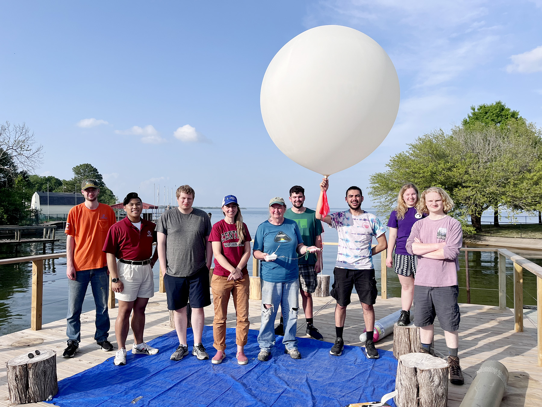
CWU physics professor, students join national eclipse research project
April 24, 2024
by
David Leder
Read More
Read more about this article.
Clear All
Search Results